An elderly pencil

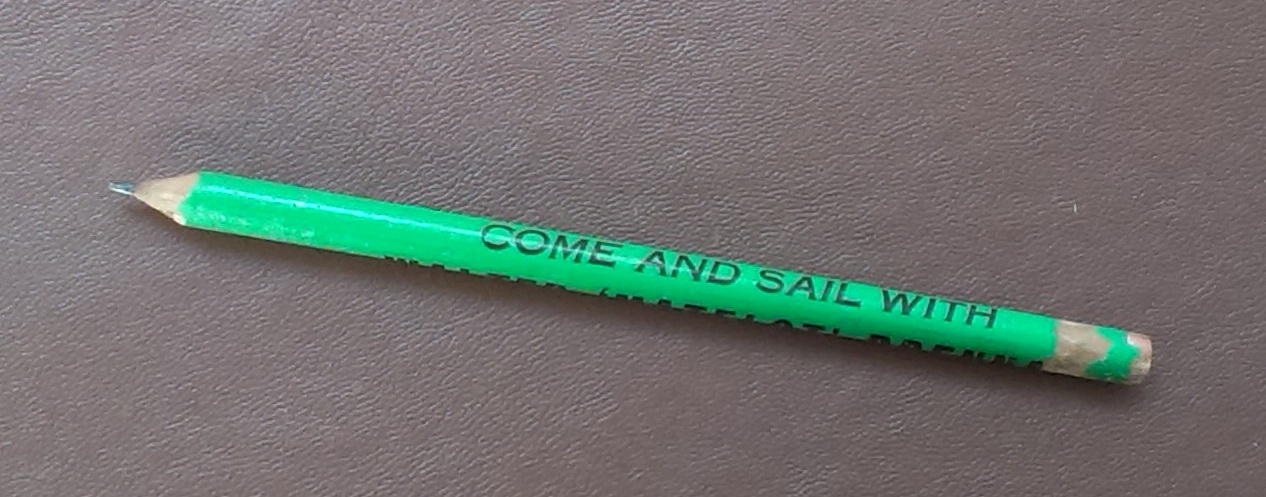
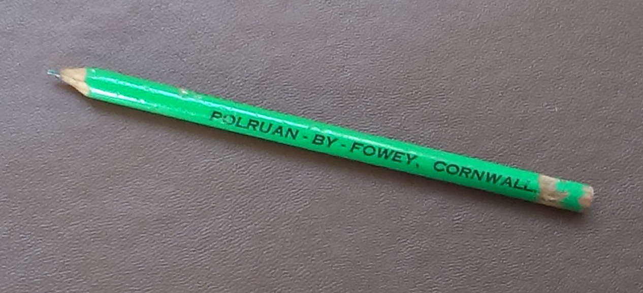
We have had the decorators in and everything but everything has been boxed up. The job has been so long that all our cardboard boxes are now hidden wells of discovery,  Looking through one such box. I found this pencil.

IMAG0261a

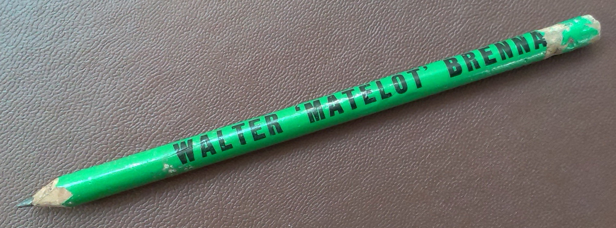
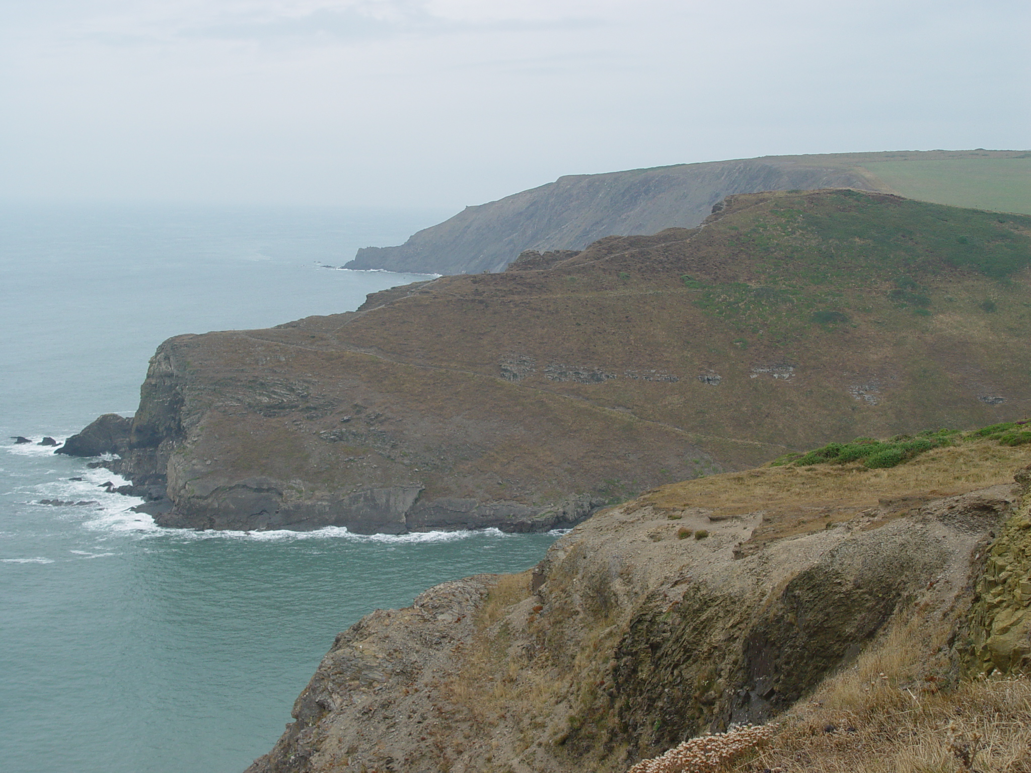
Walter Brennan taught me to sail. I was 13 or 14 at the time – so the pencil is a little over 50 years old.

It was inexpensive – free, in fact, because he gave them away. It hasn’t been used constantly but it has survived over the years where a number of expensive and increasingly sophisticated computers have not. And whereas those computers became obsolete, this piece of kit will still do what it was designed to do – act as a printer for whatever is going on in my head.

2013-11-08 15.34.56a

Obviously it is ancient hardware and I don’t offer it as an alternative to a computer – (certainly not with my brain!), but as a design that stands the test of time.

Having found it again, I am able to use it instantly – no recharging,  no cables, no wireless router, no waiting for startup, no searching for software and apps, no need to update.  It is portable and versatile. So is my mobile phone – but I guarantee my pencil will outlive my mobile too. (And I can’t chew the end of my mobile).

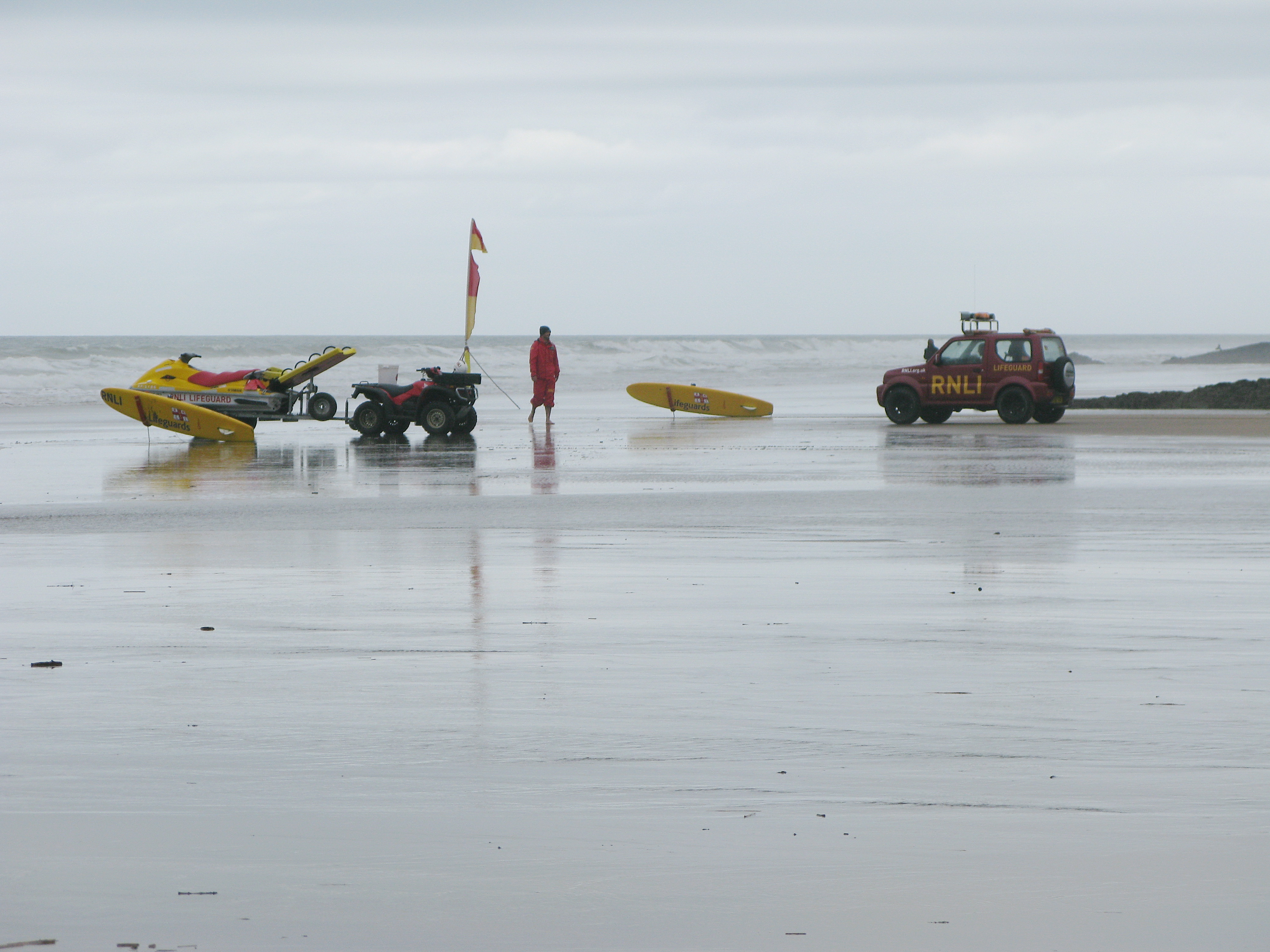
On the boat, I have three versions of gps – plus a clutch of 2B pencils.

If you’re younger than thirty you possibly don’t care. That’s ok. But at the weekend I watched my three year-old grandson climb the stairs while watching a television programme on the iPad he was holding. He had found the app and opened the programme himself. I don’t suppose he will be impressed if I leave him my pencil in my will. However, my pencil will last longer than his iPad.

2013-11-08 15.34.45a

Perhaps the pencil will be the shape of computers to come.

Who knew they would reduce a computer to look like a large postcard?

Who knew a smart phone would become the size of a small chocolate bar?

All power to the pencil.

Rhumb Line

So I woke up in the middle of the night wondering whether ‘about 1900 nautical miles’ was really the distance from Steeple Point to Quirpon Island off the northern tip of Newfoundland or whether I had been sloppy in using the Google Earth ruler to measure it. This got me to thinking about rhumb lines.

The Wikipedia definition of Rhumb Line is:

  • “In navigation, a rhumb line . . . is a line crossing all meridians of longitude at the same angle, i.e. a path derived from a defined initial bearing. That is, upon taking an initial bearing, one proceeds along the same bearing, without changing the direction as measured relative to true north.”

My measurement wasn’t “a line crossing all meridians of longitude at the same angle” but a line crossing all meridians of longitude at the same latitude.

There will be a difference in the lengths of these lines. How much longer will depend how far north the lines are drawn, because of the spherical nature of the earth. The question for me was whether the Google Earth ruler measurement differs from other means of measuring the distance.

So, I reviewed the measurements.

Firstly, for my latitude line, I needed to be more accurate in my landfall in Newfoundland.

The coordinates for Steeple Point are: 50 52 34N  004 33 39W

For Cape Bauld Lighthouse on Quirpon Island the northern tip of Newfoundland: 51 38 24N  055 25 36W

If we move 55 miles south as the crow flies, we come to the harbour at Conche – the coordinates  here are: 50 53 09N  55 53 22W – very nearly on the same latitude as Steeple Point.

The Google Earth ruler gives a length from Steeple Point to Conche of 1,915 nautical miles.

I looked for a site that calculates the Rhumb line and came across this one Movable Type Scripts.

Entering the coordinates for Steeple Point and Conche gave me:

  • Distance:            3,536 km (to 4 SF*) – 1,908 nautical miles
  • Initial bearing:     290°02′46″
  • Final bearing:     249°13′06″
  • Midpoint:            53°38′41″N, 030°17′27″W

You will notice that, whereas the distance is fairly accurate, this isn’t strictly a rhumb line because the bearings are not the same.

Best I can do for the moment.

By the way, Conche looks a good place to visit in summer.

Steeple Point

It has been well over a year since I last posted here. There are reasons for this and I will talk about them in time.

But now that I am ready to start again, I find that the title  ‘bill’s boatblog’ does not adequately cover what I want to say.  I want to reflect wider horizons. However, I don’t want to start a new blog – life’s too short.  Hence the new title.

I have changed the font but kept the general layout – there is a lot of historical material that I have posted over the past six or seven years that I would like to keep and one or two readers may find  the book references useful.

WordPress has developed into a much more sophisticated software package since my first timid attempts at posting.  This is a good thing – we all like to move forward. My first thoughts were that more sophistication means more complication – the process taking over the content. In fact, the changes have made it easier to post on this site. I look forward to more posts.

~~~

Steeple Point - standard

I have chosen Steeple Point – a place I have mentioned often. It plays an important part in my story and now that I am moving on from my day job, I want to have a physical base with a long personal connection from which to develop the blog.  I could have used a street we have lived in – Belle Vue or Cavendish Road or South Pallant or Martins Lane  or Clonbern Road or Nayland Rd South or Stockbridge Gardens or Paradise Road or others. Yes, there are more but none have the nautical connection I am looking for. Steeple Point stretches into the sea. I knew this place before I was old enough to know I knew it.

And there’s more. If the Earth were flat and your eye a perfect instrument, you could stand on Steeple Point, look due west, and see, first of all, very slightly to the north, Cape Clear Island and Fastnet Rock and then, on the southern tip of Ireland, Mizen Head , followed by no land at all until Quirpon Island with L’Anse aux Meadows beyond on the very northern tip of Newfoundland some 1,900 nautical miles away. All between is sea and ocean, wide horizons swept by wind and weather,

DSC05589

~~~

I will still talk about the boat, and I still have an eye for Greek fishing boats particularly those in Crete. They will feature, as will the past, especially the trading ketches of North Cornwall and the Bristol Channel. But there will also be occasional notes about what is going on around me as a I age in an increasingly complex world. Like it or not, all our horizons are changing. We need to recognise those changes.

Bude, Sunday

Bude, Sunday, cloudy skies, low tide

Beginning of the season, the RNLI out in force

Image

The beach crew were checking their gear

Image

The lifeboat crew were about to launch on exercise.

Image

Elsewhere, the surf school was in full swing.

~~~

I had just been to my favourite bookshop, Books by the Sea, which was fatal. I was walking across a beach carrying two books having narrowly avoided buying a third.

The first was a good copy of Eric Hiscock’s Voyaging Under Sail, a 1977 edition of a book originally published in 1959. It is a companion to Cruising Under Sail which I bought many years ago.

Eye-brows are usually raised when I return home with more ‘boat books’. The question has even been asked, “Why buy books when you can get most of the information for free in easily digested packages via Google?” Well, maybe you can, but you don’t get the author.

Even if the technology is outdated,( and it certainly is in the chapters on electrics and photography), Eric and Susan Hiscock’s books reflect their day-to-day learning from their own experience and their continual application of other ideas that they have picked up in their travels. The knowledge, skills and attitudes reflected here are hard won,

Put glibly, their’s is on-the-job learning. Those of us who spend a lot of time book learning a) should get out more, and b), as importantly, should very carefully pick the authors we learn from. With that in mind, the Hiscock’s books should be compulsory reading for anyone who wishes to put their nose beyond the breakwater.

~~~

I was dubious about the second book, then bought it anyway – The Design of Sailing Yachts, by Pierre Gutelle.

This is technical stuff. “The author first considers the air, wind, water and wave and then goes on to the theory of aero- abnd hydro-dynamics and such topics as friction, form-drag, cavitation and viscosity. There follow chapters on the equilibrium of both transverse and longitudinal stability of sailing yachts . . .”

It is full of diagrams, graphs and formulae, a combination that I would normally run a mile to avoid. However, I made myself comfortable in my mother-in-law’s front room, ignored the football on the television and had a go. A while later, I realised I was absorbed. This was physics at a much higher level than I normally tackle, put in a way that I can understand. Extraordinary!

Sailing Blue Mistress has taken on a new dimension.

Ceres – putting to sea

~~~

Watching the merchant ships leaving Bude must always have been a event

~~~

On the back of this photograph, my grandfather has written, “Can see her noble shape in this.”

~~~

~~~

From a series of recently rediscovered photographs that had lain pressed in a book for the past ten years.

For the previous sets hereherehere and here, for an overview of the harbour at Bude here

Ceres – between trips

Taking advantage of low tide.

Enjoy the detail in this photograph – rudder, blocks, hobble boat, people on beach, men working.

“Mr Health and Mr Safety, all of these children gained from the experience.”

The definition is not so good in the photo, but the sentiment is.

~~~

From a series of recently rediscovered photographs that had lain pressed in a book for the past ten years.

For the previous set herehere and here, for an overview of the harbour at Bude here

Ceres offloading

The turn-around had to be quick and slick between tides . . .

. . . with an eye on the weather

~~~

Horses worked better then vehicles on the beach, but . . .

~~~

. . . here, on the lower wharf in Bude Canal Basin, the trains are preparing to take over.

~~~

From a series of recently rediscovered photographs that had lain pressed in a book for the past ten years.

For the previous set here and here, for an overview of the harbour at Bude here

    Ceres at anchor

    These photographs were taken at full tide.

    A few hours later, she would be high and dry on the sand.

    The hobble boat taking a line to the mooring post

    ~~~

    ~~~

    ~~~

    ~~~

    From a series of recently rediscovered photographs that had lain pressed in a book for the past ten years.

    For the previous set here, for an overview of the harbour at Bude here

    The ketch ‘Ceres’ entering Bude


    Six pictures of Ceres found recently – pressed between the pages of an old volume.

    Several years ago years, a sudden flood swamped the old leather suitcase they’d been lying in. They were all damaged – water-marked and curled. The flattening-them-out-in-an-old-book trick seems to have worked.

    ~~~

    Here she is rounding Barrel Rock. A hobble boat is waiting just inside Chapel Rock

    The crew are working hard, preparing mooring lines; the helmsman barely visible in the stern.

    On another occasion, she enters Bude with her mainsail set.

    Bude seawater swimming pool is to the right of the picture

    By the size of the bow wave, the main seems to be helping the engine, perhaps on a falling tide.

    With hobble boat in tow

    ~~~

    There were several more old photos of Ceres in those pages.

    I will group together and post them as a series.