Wind and tide

Our thoughts are with the families of those who lost their lives in yesterday’s extreme weather.

In Teignmouth, we were on the edge of it.

DSC_7825

Blue Mistress was snug, but the wind was blowing downriver and the incoming tide made for choppy water. In these conditions, there is a tendency for the boat to ride onto the mooring buoy. This has damaged the bow in the past. Padding the shackle and swivel has helped.

DSC_7827

The two rows of moorings in the centre of the stream are swing moorings, the shallower moorings at the edge of the stream are fore-and-aft. The long keels of the Folksong and the Contessa 26 are holding the vessels more or less to the tide, whereas the three fin-keeled yachts beyond them are being swung by the wind.

DSC_7831

The effect of the wind against the tide is more obvious here. The wind is pushing the two bigger yachts side on to the tide, hence the heeling. The gentleman aboard the far boat is waiting for it to float.

All the while, the bridge was whistling.

Images by Bill Whateley

The Exe – 6/6

DSC_6481

At the No.8 buoy the channel turns South away from the coast. These final eight buoys – (red can buoys even numbered, green conical buoys odd-numbered), lead out to the Exe Approach buoy and the sea. As I raise sail, a yacht passes, running for the channel. We raise hands, exchanging friendly waves. Ahead of me, a distant yacht is tacking along the coast towards Berry Head.

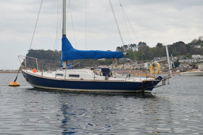
Early this morning, in the calm of the mooring at Turf Lock, I bent on the light genoa. This is now set and drawing well. The wind has got up and blows from a little West of South, the sea is choppy. The wind will increase this afternoon, but I hope not too much in the six short miles I have to cover. It will be a very close haul to Teignmouth, the contrast from this morning complete.

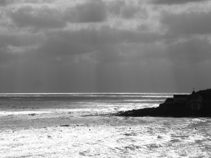
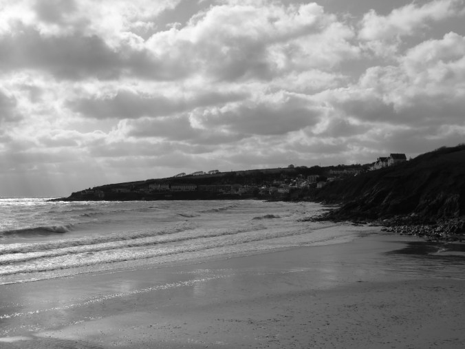
The yacht ahead turns off Teignmouth and heads out to sea to clear Hope’s Nose on the next tack. I watch the coast go by – Dawlish Warren, Langstone Point, Dawlish, the Parson and the Clerk, Teignmouth. The mainline trains hug the coast. The sun dips in and out behind the clouds. ‘Blue Mistress’ rides the waves with an easy motion. I concentrate on steering her towards The Ness and the entrance to the Teign.

When we get there – (in good time, around 1530), the wind has risen another notch and, if we were going further, I would have had to change the genoa for the working jib. Approaching the entrance, I feel the Captains tensing, gathering together, looking over their shoulders at me – (see ‘The Exe – 3/6’ for details of The Captains). The sea is choppier here, affected by wind over the falling tide from the estuary. Turning into the that wind to drop the sails, my usual slick procedure for dropping the genoa neatly onto the foredeck fails and the leach drops into the sea. I go forward to retrieve it, cursing mildly, my routine broken. By now the mainsail should be down. The boat is bouncing up and down in the sea, the mainsail is flapping wildly, I slip over in the cockpit like a rookie. Eventually the tangle is sorted out and the boat settles down.

In the meantime, The Captains have raised their eyebrows and looked away! But, as I say to them, when things go wrong as they will, a good sailor will deal with them quickly and calmly. So, when I get back to the mooring, (under time-pressure to be home), knowing I have to tidy ship and inflate the dinghy before I can go ashore, only to find the mooring lines tangled tightly round the buoy, you will understand my reaction. (Quickly and calmly, I say!)

DSC_6609

These two days have been a ‘wandering’ – some might call it a mini adventure but I don’t believe it qualifies for that. I took two days out to experience The Exe Estuary and to reflect on what it might have been like for my forebears when they took their Westcountry trading ketch up to Topsham and Exeter. I am now back in Teignmouth, which they also visited on several occasions.

For example, on 15th September 1888, the ‘Ceres’, Captain Walter Petherick, master, left Saundersoot in South Wales carrying 82 tons of coal for Teignmouth. She arrived in good time and on 29th September, she left Teignmouth for Bristol, carrying 82 tons of clay. Maybe she berthed at New Quay to offload the coal and take on clay, maybe further upstream. One day I shall find out.

P1080152a

I finally get home at 1730. The day is not over. Two hours later, we are sitting in The Pavilions Teignmouth watching a simultaneous broadcast from the National Theatre. In 1966, Tom Stoppard wrote a play around two minor characters in Shakespeare’s “Hamlet”, namely  “Rosencrantz and Guildenstern are Dead”. Peggy and I first saw it an unbelievable fifty years ago. The word-play is as enjoyable today as it was then.

Still buzzing from my two days on the boat, I wonder how my great grandfather would have thought of this play. Was he in a position to have seen any of Shakespeare’s plays? Would he have wanted to? And what about my great-grandchildren? Will they enjoy some future production with its fast word-play? Times change. Today we are able to share laughter and sighs with audiences across the globe simultaneously, something we never even thought of in the 1960’s. How will they be viewing such plays in future – a hologram in the round perhaps?

Or will more mundane matters concern them – the erosion of tolerance, patience and respect in our political relationships; the effect on our lives of the change in weather patterns? Speak up now, there’s plenty to do.

Images by Bill Whateley


Vanuatu – Cyclone Pam

The New Zealand Herald has a report from one of their reporters in Vanuatu this morning – here. The video clip shows the destruction in Port Vila. Sadly, there has been loss of life. I understand wind speeds were in the 300km/h mark.

Yesterday, Webb Chiles carried a photograph of the damage in the harbour and a first hand description of the harbour itself – here

Continue reading

Speak up for the horses

You carefully pilot your ship into harbour at the top of the tide. You wait until the tide goes out and there is clear ground around the ship. Then you bring the horse and a cart to offload into. The cargo is heavy – coal, or slag, so you harness two horses in tandem to haul the load across the beach and up to the stores.

Continue reading

Brixham to Plymouth – reflection – tidal race

(Continued . . .)

This series of five posts outlines a September passage from Plymouth to Teignmouth and back.

(Click on image to enlarge)

DSC_5144

The interruption to my passage plan has meant that I have to get from Brixham to Plymouth, a distance of a little over 40 nautical miles by this evening. This is no problem on paper – but there will probably be no time for fishing. Also the tide will be wrong going round Start Point. I had planned to round the Point, which is about 13 nm along the coast from here, yesterday evening with the tide carrying me, I will now reach it around the middle of today with the tide against me. The wind has gone round  to the north east – almost the opposite of yesterday morning.

Continue reading

Rhumb Line

So I woke up in the middle of the night wondering whether ‘about 1900 nautical miles’ was really the distance from Steeple Point to Quirpon Island off the northern tip of Newfoundland or whether I had been sloppy in using the Google Earth ruler to measure it. This got me to thinking about rhumb lines.

The Wikipedia definition of Rhumb Line is:

  • “In navigation, a rhumb line . . . is a line crossing all meridians of longitude at the same angle, i.e. a path derived from a defined initial bearing. That is, upon taking an initial bearing, one proceeds along the same bearing, without changing the direction as measured relative to true north.”

My measurement wasn’t “a line crossing all meridians of longitude at the same angle” but a line crossing all meridians of longitude at the same latitude.

There will be a difference in the lengths of these lines. How much longer will depend how far north the lines are drawn, because of the spherical nature of the earth. The question for me was whether the Google Earth ruler measurement differs from other means of measuring the distance.

So, I reviewed the measurements.

Firstly, for my latitude line, I needed to be more accurate in my landfall in Newfoundland.

The coordinates for Steeple Point are: 50 52 34N  004 33 39W

For Cape Bauld Lighthouse on Quirpon Island the northern tip of Newfoundland: 51 38 24N  055 25 36W

If we move 55 miles south as the crow flies, we come to the harbour at Conche – the coordinates  here are: 50 53 09N  55 53 22W – very nearly on the same latitude as Steeple Point.

The Google Earth ruler gives a length from Steeple Point to Conche of 1,915 nautical miles.

I looked for a site that calculates the Rhumb line and came across this one Movable Type Scripts.

Entering the coordinates for Steeple Point and Conche gave me:

  • Distance:            3,536 km (to 4 SF*) – 1,908 nautical miles
  • Initial bearing:     290°02′46″
  • Final bearing:     249°13′06″
  • Midpoint:            53°38′41″N, 030°17′27″W

You will notice that, whereas the distance is fairly accurate, this isn’t strictly a rhumb line because the bearings are not the same.

Best I can do for the moment.

By the way, Conche looks a good place to visit in summer.